
Researchers on the storm
Wednesday, 16 April, 2014
When it comes to studying thunderstorms, the best lab is the site of the storm itself. That’s where Joshua Soderholm, a PhD student at the University of Queensland, has been conducting his research project into the collisions between thunderstorms and sea breezes.
According to Soderholm, “History shows us that the most severe storms often develop after a sea-breeze interaction” (as a result of the extra moisture and winds), yet thunderstorms in coastal environments have received limited attention in comparison to storms in the central United States. There is a gap in our knowledge of the outcomes of these collisions, he said, with storms having been “observed to sometimes weaken; other times intensify; and even change direction after colliding with a sea breeze”.
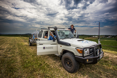
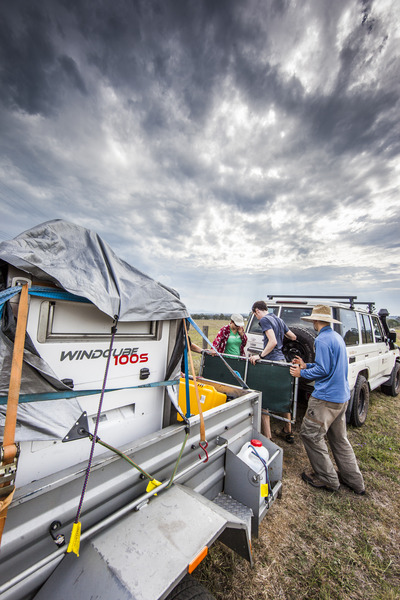
This poses a significant problem for forecasters attempting to predict storm tracks over the short term, and for the public who reside in the surrounding area. So Soderholm set out to improve the accuracy of public storm warnings in coastal environments where a sea breeze is occurring. From November 2013 to January 2014, he and his team headed out to the coastal plains of south-east Queensland over 16 storm days.
“The best part of conducting field research is being able to see the concepts and theories come to life before your eyes,” said Soderholm. “It gives you an appreciation and understanding of the science which could never be gained in sitting in an office.”
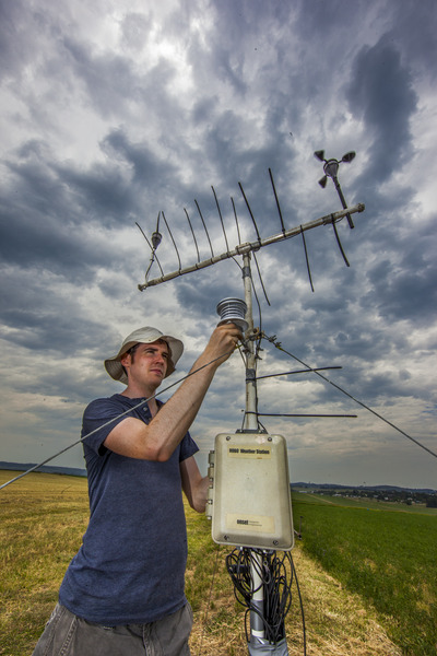
Along with conventional measuring equipment such as meteorological balloons, weather stations and boundary layer profilers, the researchers deployed an instrument called a scanning Doppler lidar. Doppler lidars observe winds using “an infrared laser to detect the motion of suspended dust and aerosols in ‘clear air’”, said Soderholm, “… [which] is critical when looking at sea-breeze wind changes and gusts ahead of thunderstorms”.
The researchers observed “a broad spectrum of thunderstorm systems interacting with the sea breeze”, Soderholm said, with “rapid changes to storm intensity and track”. In fact, he added, “The diversity of interactions exceeded our expectations and provided useful information for refining our strategy and target storm types for when we go out again in the 2014-2015 storm season.”
When the next season hits, the researchers will be deploying the mobile Doppler weather radar and CP-2 radar, operated by the Centre for Australian Weather and Climate Research. These dual-polarmetric radars “collect additional information on the microphysical properties of precipitation and are less likely to suffer signal attenuation through heavy precipitation”, Soderholm said.
Until then, Soderholm and his team will have to settle for a more conventional lab, where they will “explore the mechanisms behind each interaction event and develop concepts which can be applied to all events”. It is with this data that they hope to enable earlier and more accurate storm warnings
Found: the most massive stellar black hole in the Milky Way
With a mass 33 times that of the Sun, and based a mere 1926 light-years away, Gaia BH3 is the...
Astronauts will soon grow plants on the Moon
When humans take their first steps back on the Moon after 50 years during the Artemis III...
How plant leaves ensure optimal area for photosynthesis
The small RNA molecules in the cells of the growing leaf set in motion a genetic process that...


